Midcontinent Rift System in Northeastern Kansas
DOI:
https://doi.org/10.17161/kgsbulletin.no.237.20417Abstract
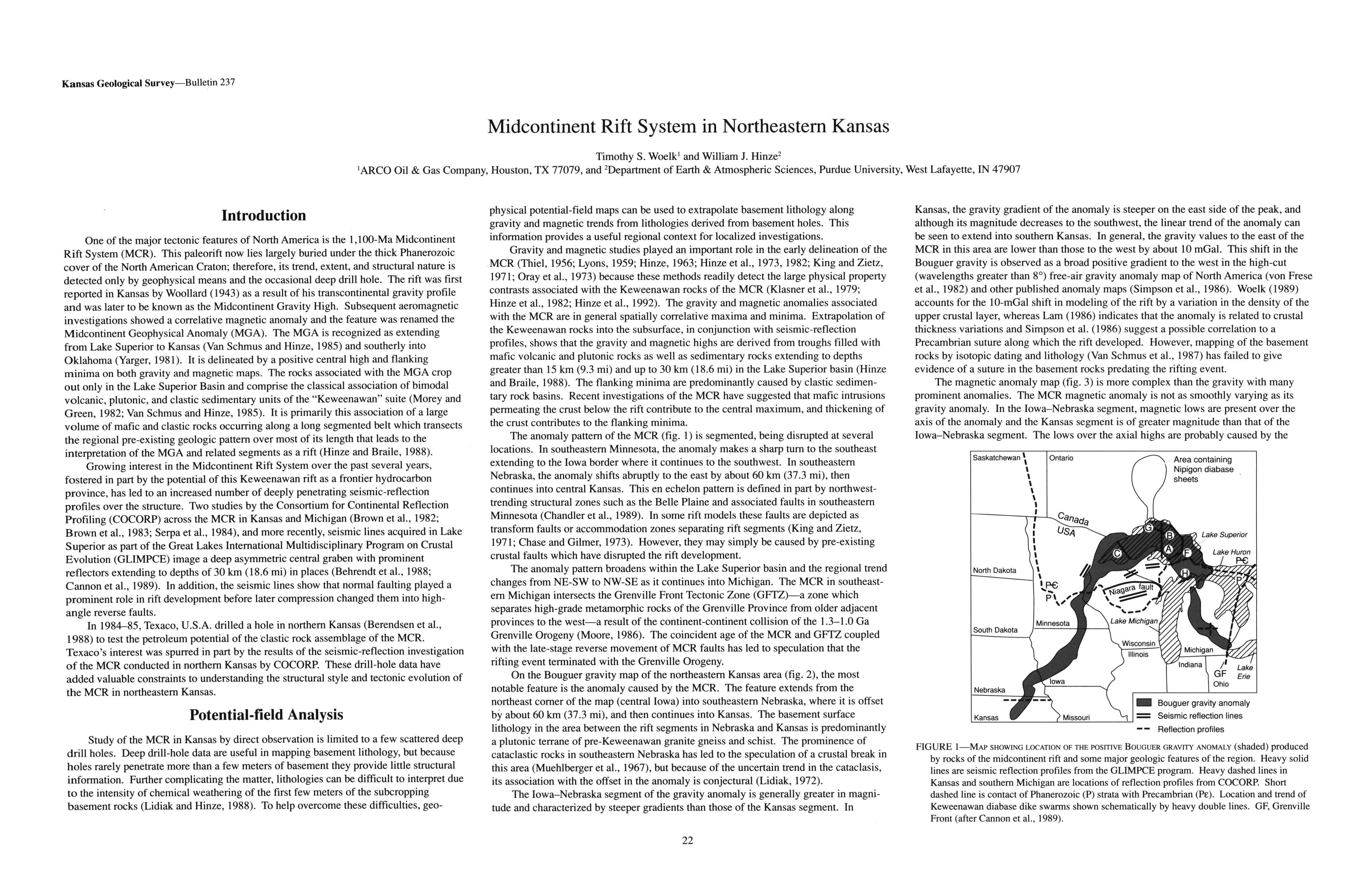
One of the major tectonic features of North America is the 1,100-Ma Midcontinent Rift System (MCR). This paleorift now lies largely buried under the thick Phanerozoic cover of the North American Craton; therefore, its trend, extent, and structural nature is detected only by geophysical means and the occasional deep drill hole. The rift was first reported in Kansas by Woollard (1943) as a result of his transcontinental gravity profile and was later to be known as the Midcontinent Gravity High. Subsequent aeromagnetic investigations showed a correlative magnetic anomaly and the feature was renamed the Midcontinent Geophysical Anomaly (MGA). The MGA is recognized as extending from Lake Superior to Kansas (Van Schmus and Hinze, 1985) and southerly into Oklahoma (Yarger, 1981). It is delineated by a positive central high and flanking minima on both gravity and magnetic maps. The rocks associated with the MGA crop out only in the Lake Superior Basin and comprise the classical association of bimodal volcanic, plutonic, and clastic sedimentary units of the "Keweenawan" suite (Morey and Green, 1982; Van Schmus and Hinze, 1985). It is primarily this association of a large volume of mafic and clastic rocks occurring along a long segmented belt which transects the regional pre-existing geologic pattern over most of its length that leads to the interpretation of the MGA and related segments as a rift (Hinze and Braile, 1988).
Growing interest in the Midcontinent Rift System over the past several years, fostered in part by the potential of this Keweenawan rift as a frontier hydrocarbon province, has led to an increased number of deeply penetrating seismic-reflection profiles over the structure. Two studies by the Consortium for Continental Reflection Profiling (COCORP) across the MCR in Kansas and Michigan (Brown et al., 1982; Brown et al., 1983; Serpa et al., 1984), and more recently, seismic lines acquired in Lake Superior as part of the Great Lakes International Multidisciplinary Program on Crustal Evolution (GLIMPCE) image a deep asymmetric central graben with prominent reflectors extending to depths of 30 km (18.6 mi) in places (Behrendt et al., 1988; Cannon et al., 1989). In addition, the seismic lines show that normal faulting played a prominent role in rift development before later compression changed them into high-angle reverse faults.
In 1984-85, Texaco, U.S.A. drilled a hole in northern Kansas (Berendsen et al., 1988) to test the petroleum potential of the "clastic rock assemblage of the MCR. Texaco's interest was spurred in part by the results of the seismic-reflection investigation of the MCR conducted in northern Kansas by COCORP. These drill-hole data have added valuable constraints to understanding the structural style and tectonic evolution of the MCR in northeastern Kansas.
Downloads