Shallow Seismic-reflection Study of a Salt-dissolution Subsidence Feature in Stafford County, Kansas
DOI:
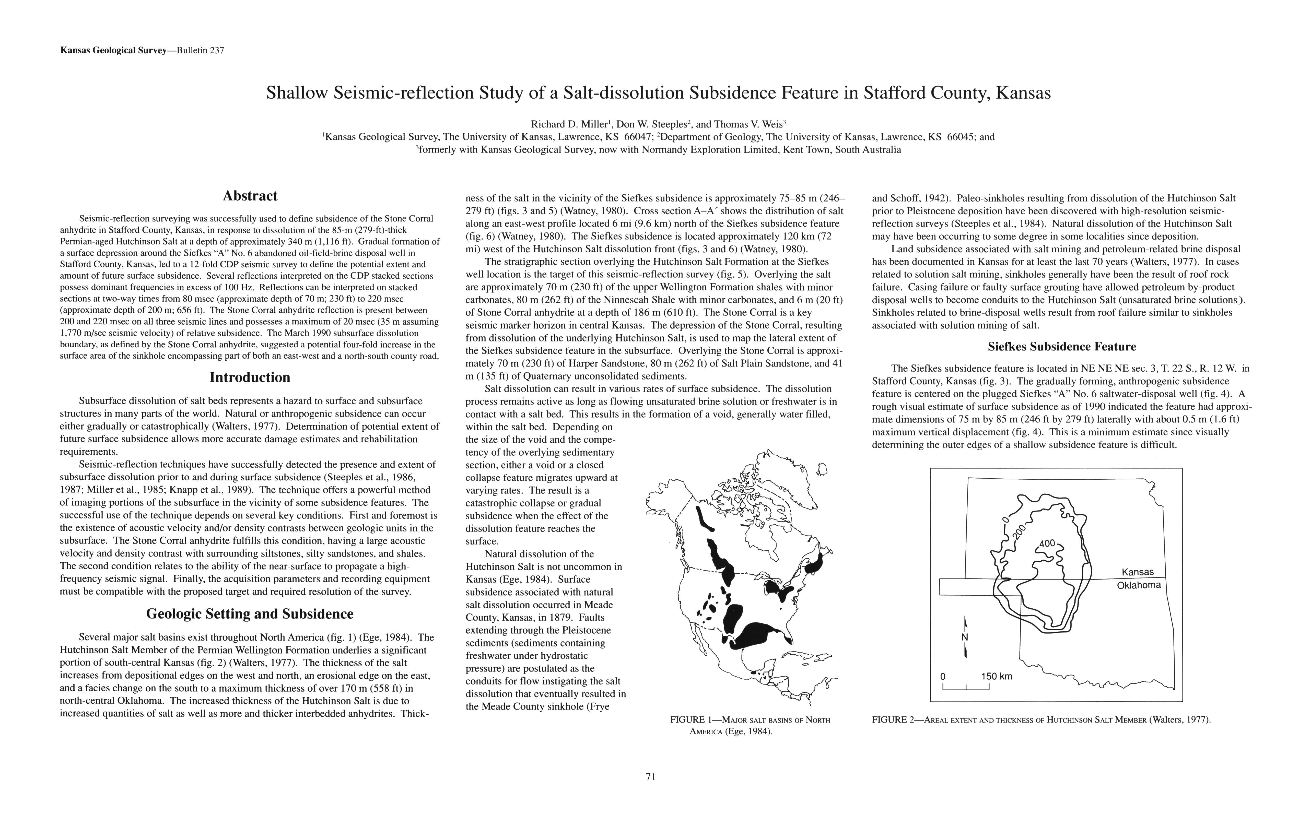
https://doi.org/10.17161/kgsbulletin.no.237.20426Abstract
Seismic-reflection surveying was successfully used to define subsidence of the Stone Corral anhydrite in Stafford County, Kansas, in response to dissolution of the 85-m (279-ft)-thick Permian-aged Hutchinson Salt at a depth of approximately 340 m (1,116 ft). Gradual formation of a surface depression around the Siefkes "A" No. 6 abandoned oil-field-brine disposal well in Stafford County, Kansas, led to a 12-fold COP seismic survey to define the potential extent and amount of future surface subsidence. Several reflections interpreted on the CDP stacked sections possess dominant frequencies in excess of 100 Hz. Reflections can be interpreted on stacked sections at two-way times from 80 msec (approximate depth of 70 m; 230 ft) to 220 msec (approximate depth of 200 m; 656 ft). The Stone Corral anhydrite reflection is present between 200 and 220 msec on all three seismic lines and possesses a maximum of 20 msec (35 m assuming 1,770 m/sec seismic velocity) of relative subsidence. The March 1990 subsurface dissolution boundary, as defined by the Stone Corral anhydrite, suggested a potential four-fold increase in the surface area of the sinkhole encompassing part of both an east-west and a north-south county road.
Downloads