Cheyenne Bottoms Basin--Geophysical Study of a Natural Land-sink Area in Central Kansas
DOI:
https://doi.org/10.17161/kgsbulletin.no.237.20427Abstract
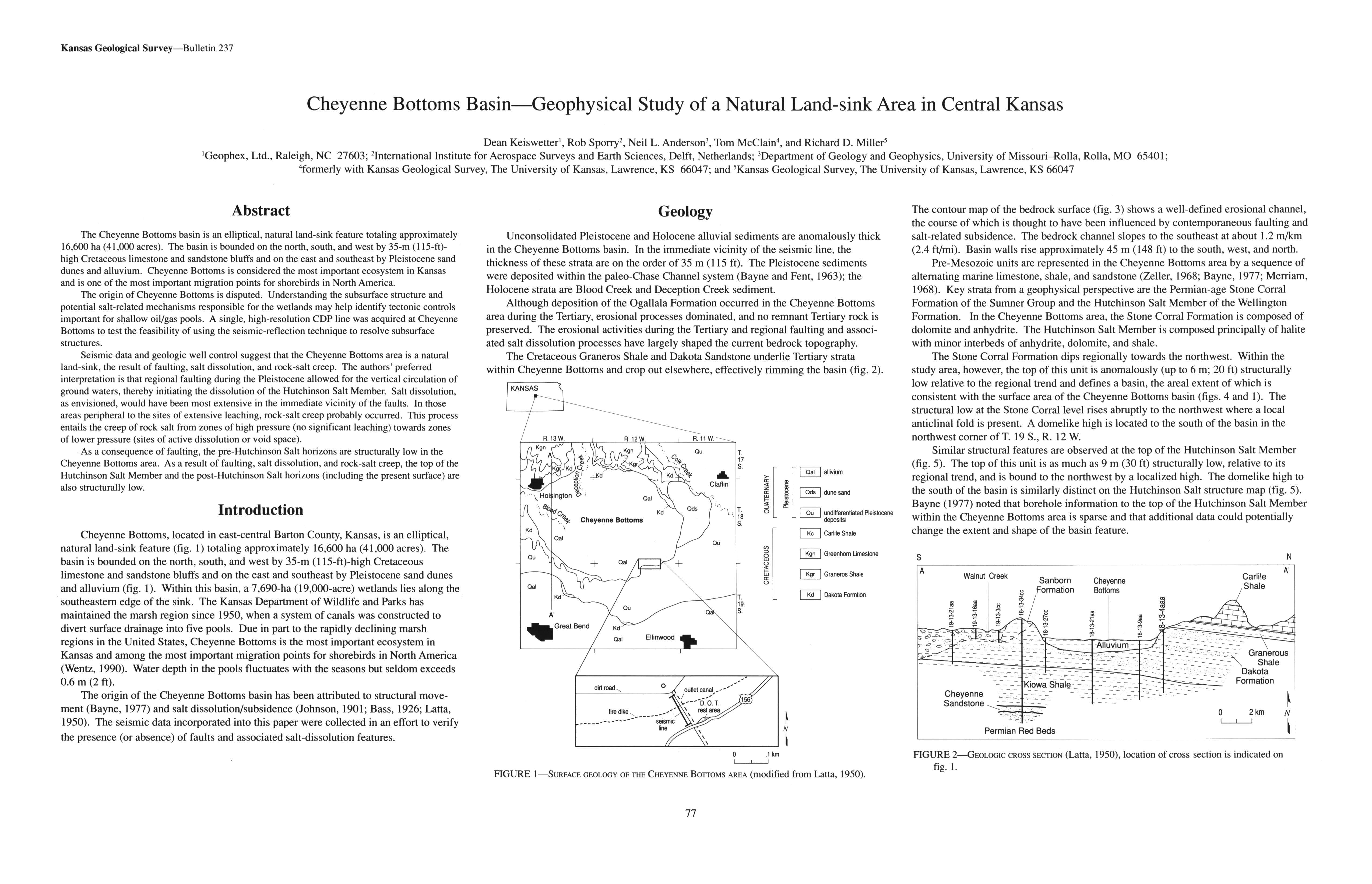
The Cheyenne Bottoms basin is an elliptical, natural land-sink feature totaling approximately 16,600 ha (41,000 acres). The basin is bounded on the north, south, and west by 35-m (115-ft)-high Cretaceous limestone and sandstone bluffs and on the east and southeast by Pleistocene sand dunes and alluvium. Cheyenne Bottoms is considered the most important ecosystem in Kansas and is one of the most important migration points for shorebirds in North America.
The origin of Cheyenne Bottoms is disputed. Understanding the subsurface structure and potential salt-related mechanisms responsible for the wetlands may help identify tectonic controls important for shallow oil/gas pools. A single, high-resolution CDP line was acquired at Cheyenne Bottoms to test the feasibility of using the seismic-reflection technique to resolve subsurface structures.
Seismic data and geologic well control suggest that the Cheyenne Bottoms area is a natural land-sink, the result of faulting, salt dissolution, and rock-salt creep. The authors' preferred interpretation is that regional faulting during the Pleistocene allowed for the vertical circulation of ground waters, thereby initiating the dissolution of the Hutchinson Salt Member. Salt dissolution, as envisioned, would have been most extensive in the immediate vicinity of the faults. In those areas peripheral to the sites of extensive leaching, rock-salt creep probably occurred. This process entails the creep of rock salt from zones of high pressure (no significant leaching) towards zones of lower pressure (sites of active dissolution or void space).
As a consequence of faulting, the pre-Hutchinson Salt horizons are structurally low in the Cheyenne Bottoms area. As a result of faulting, salt dissolution, and rock-salt creep, the top of the Hutchinson Salt Member and the post-Hutchinson Salt horizons (including the present surface) are also structurally low.
Downloads