Case History of Walta Field (Simpson and Mississippian), Sumner County, Kansas
DOI:
https://doi.org/10.17161/kgsbulletin.no.237.20438Abstract
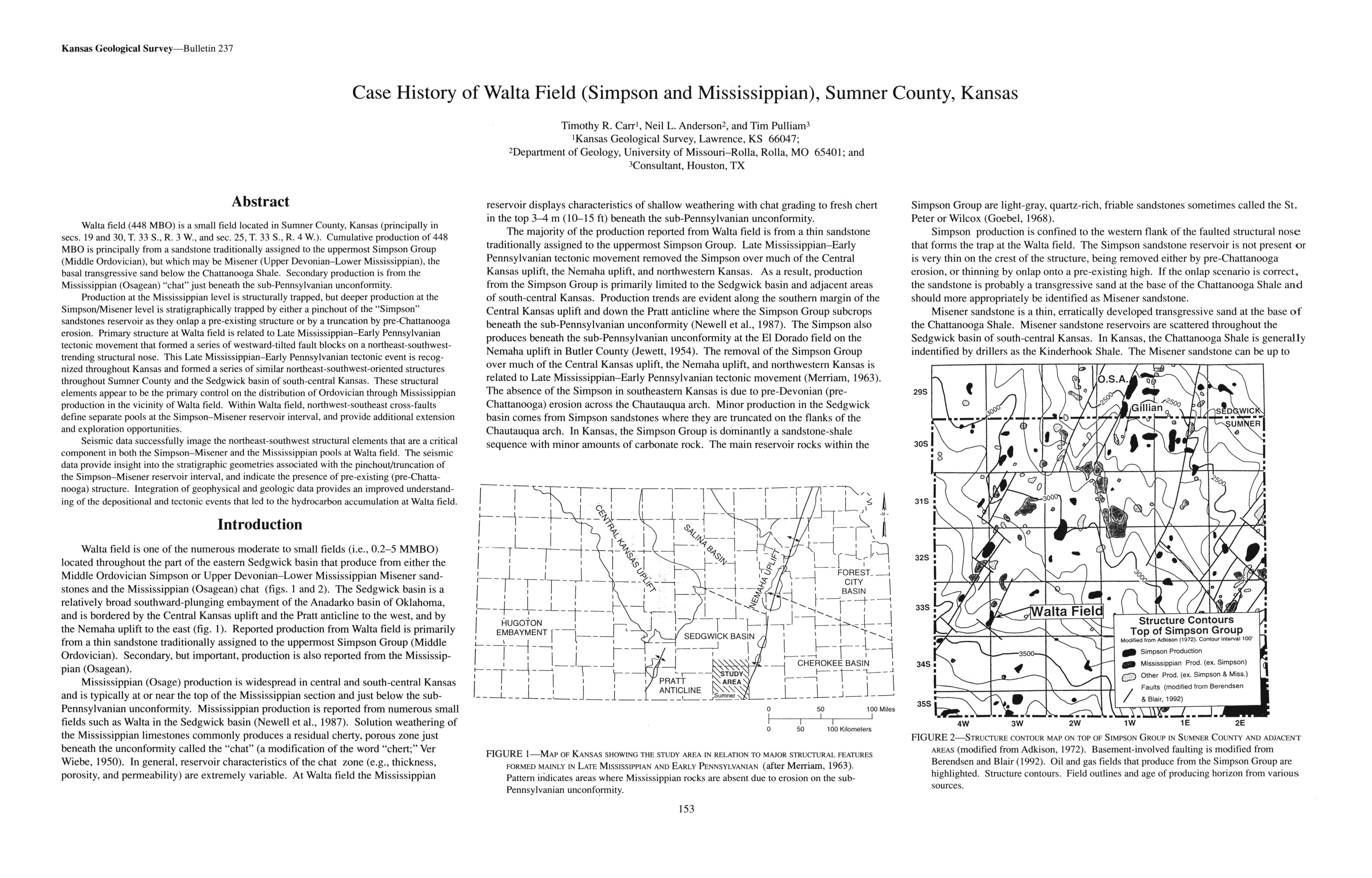
Walta field (448 MBO) is a small field located in Sumner County, Kansas (principally in secs. 19 and 30, T. 33 S., R. 3 W., and sec. 25, T. 33 S., R. 4 W.). Cumulative production of 448 MBO is principally from a sandstone traditionally assigned to the uppermost Simpson Group (Middle Ordovician), but which may be Misener (Upper Devonian-Lower Mississippian), the basal transgressive sand below the Chattanooga Shale. Secondary production is from the Mississippian (Osagean) "chat" just beneath the sub-Pennsylvanian unconformity.
Production at the Mississippian level is structurally trapped, but deeper production at the Simpson/Misener level is stratigraphically trapped by either a pinchout of the "Simpson" sandstones reservoir as they onlap a pre-existing structure or by a truncation by pre-Chattanooga erosion. Primary structure at Walta field is related to Late Mississippian-Early Pennsylvanian tectonic movement that formed a series of westward-tilted fault blocks on a northeast-south west-trending structural nose. This Late Mississippian-Early Pennsylvanian tectonic event is recognized throughout Kansas and formed a series of similar northeast-south west-oriented structures throughout Sumner County and the Sedgwick basin of south-central Kansas. These structural elements appear to be the primary control on the distribution of Ordovician through Mississippian production in the vicinity of Walta field. Within Walta field, northwest-southeast cross-faults define separate pools at the Simpson-Misener reservoir interval, and provide additional extension and exploration opportunities.
Seismic data successfully image the northeast-southwest structural elements that are a critical component in both the Simpson-Misener and the Mississippian pools at Walta field. The seismic data provide insight into the stratigraphic geometries associated with the pinchout/truncation of the Simpson-Misener reservoir interval, and indicate the presence of pre-existing (pre-Chattanooga) structure. Integration of geophysical and geologic data provides an improved understanding of the depositional and tectonic events that led to the hydrocarbon accumulation at Walta field.
Downloads